RockWorks offers a selection of tools for the display and interpolation of lithology data.
![]() Back to Borehole Operations Summary
Back to Borehole Operations Summary
Model-Based Diagrams - Model-Based Computations - Data Tools
Model-Based Diagrams: Interpolate a solid model from the borehole lithology intervals, or read an existing lithology model, for display as:
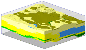
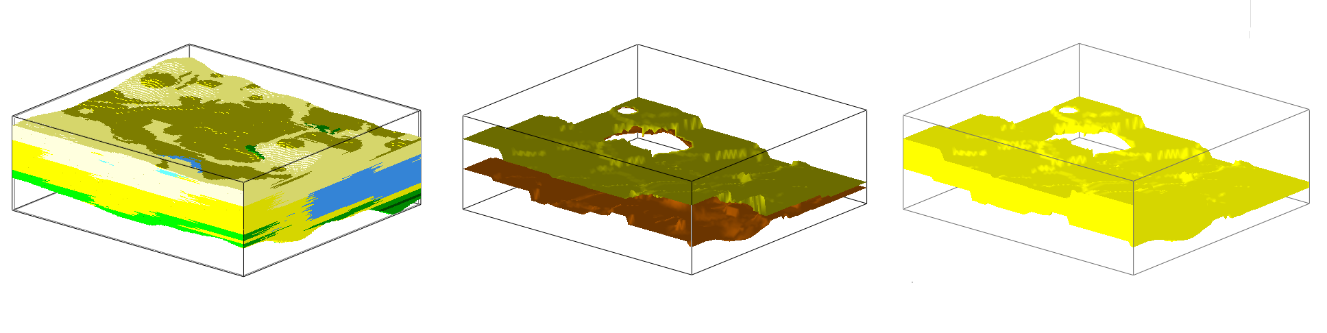
Solid: Create a 3D voxel display of an interpolated lithology model. (More info)
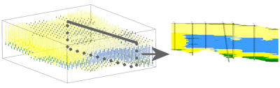
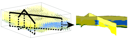
Profile: Create a profile diagram "sliced" between two points in the lithology model, with projected striplogs, and color/pattern fills. (More info)
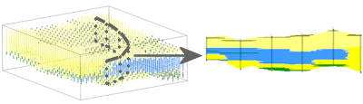
Section: Create a multi-panel 2D cross section "sliced" between multiple points in the lithology model with vertical striplogs, and color/pattern fills. (More info)
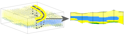
Projected Section: Create a multi-panel 2D cross section "sliced" between multiple points in the lithology model with projected striplogs, and color/pattern fills. (More info)
Fence: Create a 3D fence diagram "sliced" between multiple points in the lithology model with 3D logs and color fills. (More info)
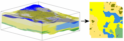
Surface Map: Create a 2D geology map representing lithology materials along a specified surface model. (More info)
Plan Map: Create a 2D geology map representing lithology materials along a horizontal slice plane. (More info)
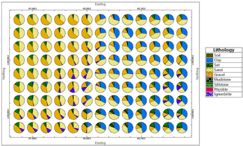
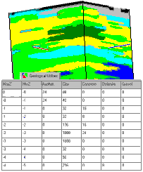
Multivariate Map: Create a map of pie charts or starbursts that depict the relative amounts of various lithologies in the vicinity of each diagram. (More info)
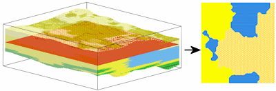
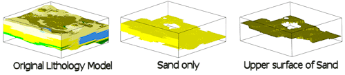
Superface Grid: Create a 2D or 3D map representing the uppermost occurrences of a specific lithology material. (More info)
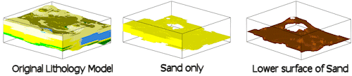
Subface Grid: Create a 2D or 3D map representing the lowermost occurrences of a specific lithology material. (More info)
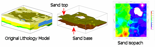
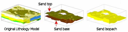
2D Isopach: Display the thickness of a specific lithology material as a contour map. (More info)
3D Isopach: Display the thickness of a specific lithology material in 3D. (More info)
Volumetrics: Compute volumes of the different material types for display in a report. (More info)
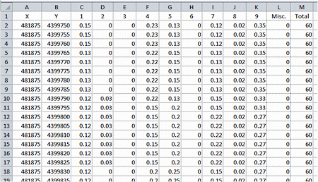
Lithology/Stratigraphy by XY: Read a lithology RwMod file and summarize the percentage of each lithotype in each XY column of nodes. (More info)
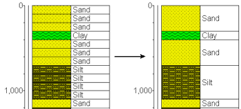
Consolidate: Consolidate contiguous lithologic intervals with identical keywords into a single interval. (More info)
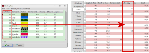
Lithology -> I-Data: Copy your lithology intervals for all boreholes to the I-Data table, recording the G value defined for the material types. (More info)
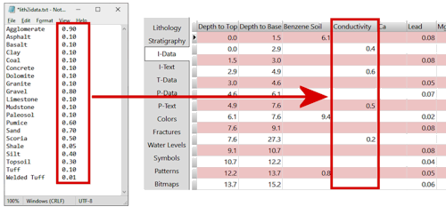
Lithology -> I-Data (Table): Convert your lithology intervals for all boreholes to the I-Data table, recording the real number value defined for the material type in a custom lookup table. (More info)
![]() Back to Borehole Operations Summary
Back to Borehole Operations Summary
![]()