Use the tools in the Graphics | Images menu to import raster images into a RockWorks project or output them to Google Earth. This topic summarizes the tools that are available - click on a link or picture for more information.
![]() Back to Graphics Menu Summary
Back to Graphics Menu Summary
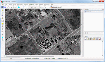
Image -> Map: Import a single raster image into RockPlot2D. (More info)
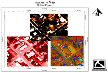
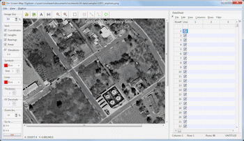
Images -> Map: Read a listing of raster image names and coordinates and display them in RockPlot2D. (More info)
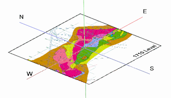
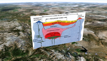
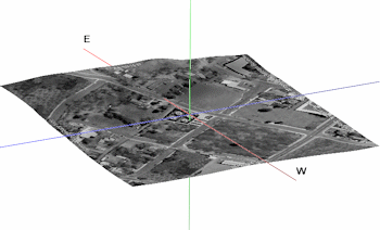
Drape: Drape a raster image over an existing grid model, for display in RockPlot3D. (More info)
Float: Float images as horizontal planes in RockPlot3D.
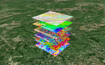
Float | Single: Float a raster image as a plane at a specified elevation, for display in RockPlot3D. (More info)
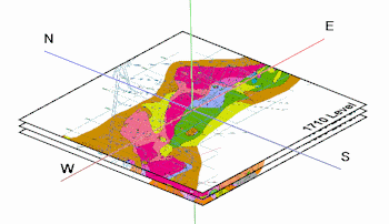
Float | Multiple: Display multiple raster images as horizontal planes at specified elevations, for display in RockPlot3D. (More info)
Vertical: Display images as vertical panels in 3D.
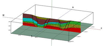
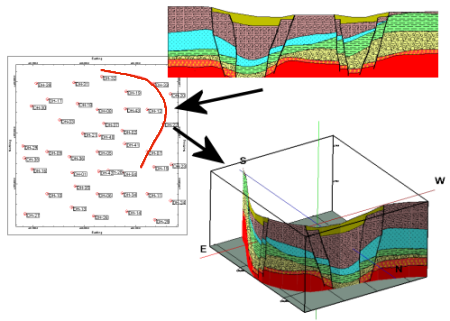
Vertical | Single: Display a single raster image as a vertical panel at a specified location, for display in RockPlot3D. (More info)
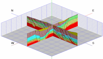
Vertical | Multiple: Display multiple raster images as vertical panels at specified locations, for display in RockPlot3D. (More info)
Vertical | Single Curved: Display a single raster image as a vertical panel, as projected along a defined polyline, for display in RockPlot3D. (More info)
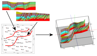
Vertical | Multiple Curved: Display a multiple raster images as vertical panels, as projected along a defined polyline, for display in RockPlot3D. (More info)
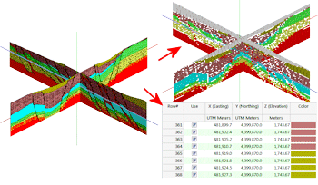
Vertical | Vertical Images - XYZC: Create a table of X/Y/Z/Color points based on images listed within the RcckWorks datasheet. (More info)
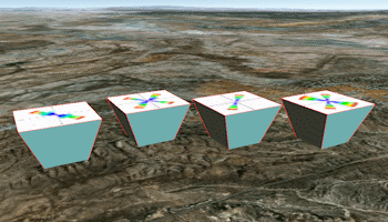
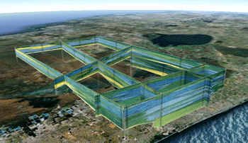
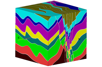
Image Cube: Display raster images on one or more cube faces for display in RockPlot3D. (More info)
Georeference: Calibrate, rotate and clip airphotos and satellite images to project dimensions. (More info)
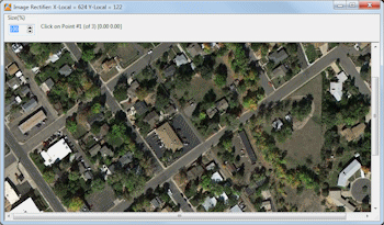
Digitize: Import a raster image, calibrate it to global coordinates, and digitize points, lines, polylines, or polygons. (More info)
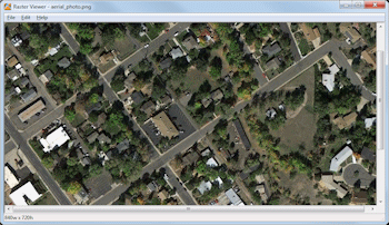
Reformat/Enhance: Open a raster image into a viewing window, and offer tools for resizing, sharpening, rotating, and resaving or saving to a different file format. (More info)
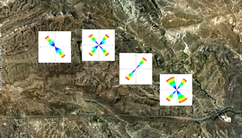
Google Earth: Display images in Google Earth.
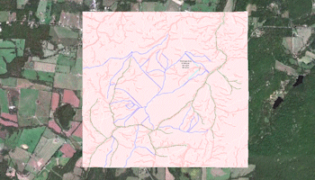
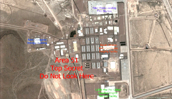
Drape - Single Midpoint: Read a listing raster images and locations from the Datasheet and plot these images in Google Earth, draped over the earth surface. Images are plotted based on a single XY location and a defined width and height. (More info)
Drape - Two Corner Points: Read a listing raster images and locations from the Datasheet and plot these images in Google Earth, draped over the earth surface. Images are plotted based on coordinates defined for their southwest and northeast corners. (More info)
Drape - Raster Labels: Read a listing of text labels, XY locations for the center points of the labels, text size and color from the Datasheet and plot the labels in Google Earth, draped over the earth surface. (More info)
Float - Single Midpoint: Read a listing of raster images from the Datasheet and plot them in Google Earth at a defined width, height, and elevation, based on a single XY location. (More info)
Float - Two Corner Points: Read a listing of raster images from the Datasheet and plot them in Google Earth at a defined elevation, based on coordinates defined for their southwest and northeast corners. More info
Vertical - Single Midpoint: Read a listing of raster images and locations from the Datasheet and plot the images vertically (perpendicular to the Earth's surface). Images are plotted based on a single XY location and a defined width and height. (More info)
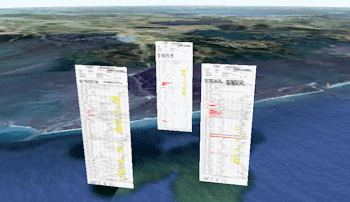
Vertical - Two Pts Simple: Read a listing of raster images and locations from the Datasheet and plot the images vertically, based on coordinates defined for their left and right edges and using a defined height. (More info)
Vertical - Two Pts Advanced: Read a listing of raster images and locations from the Datasheet and plot the images vertically. Images are plotted based on coordinates defined for their left and right edges, and base and top elevations. Vertical offset and exaggeration are available. (More info)
Vertical - 90-Degree Images: Read a listing of raster images and locations from the Datasheet and plot the images vertically. Images are plotted east-west and copied north-south, based on center point coordinates and width and height declarations, generating a 3D effect. (More info)
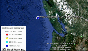
Legend: Add Image as Legend: Read a single image file and create a KML output file to display the image in the legend area of the Google Earth display, with no rescaling. (More info)
![]() Back to Graphics Summary
Back to Graphics Summary
![]()