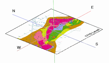
This program floats a single raster image at a specified elevation. Supported raster formats include: BMP, JPG, EMF and WMF, PCX, PNG, TGA, and TIFF.
! The raster image file must reside in the current project folder.
Menu Options
Step-by-Step Summary
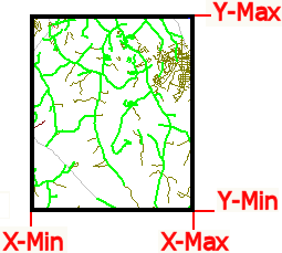
The program will read the indicated bitmap image, and, if manually specified, assign its corners the indicated coordinates. The image will be displayed in a RockPlot3D tab in the Options window.
If you requested use of an automatically-determined World file, the program will do this:
The floating image will be displayed in a RockPlot3D tab.
! If neither the 4-character nor the 3-character version of the World file exists, the program will present the user with the following error message: "Unable to locate a "World" file that corresponds to the following raster image: (file name). Neither World file naming convention was found (examples shown)."
![]() Back to Image Menu Summary
Back to Image Menu Summary
![]()