Use the programs in the Utilities | Earth menu to read spatial data from the datasheet and generate Google Earth output files which illustrate the map locations with icons, polylines, polygons, pipelines, and more. The output can be loaded automatically in Google Earth, if requested.
These programs are summarized below. Click on the links or images to jump to topics with more information.
! These programs require installation of Google Earth on your computer. Google Earth is not installed with RockWorks. Visit https://www.google.com/earth/ for download and licensing information.)
See also: Google Earth programs in the Data Import menu, Grid menu, Planes menu, Coords menu, Animate menu, and Images menu.
![]() Back to Utilities Summary
Back to Utilities Summary
Quick Links:
Icon Maps - Circle Maps - Cone Maps - Cylinder Maps
Mining Claim Maps - Oil & Gas Lease Maps - Public Land Grid Maps
Single Polygon Maps - Multiple Polygon Maps - Predefined Polygon Maps
Lineation/Arrow Maps - Single Polyline Maps - Multiple Polyline Maps
Parabolic Arrow Maps - Parabolic Line Maps - Parabolic Tube Maps
Single Pipeline Maps - Multiple Pipeline Maps - 3D Tube Maps
Point Survey Maps - Polygon Survey Maps
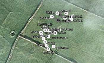
Sample Point Icons: Create maps which illustrate X,Y locations with icon symbols. The size and design of the icons can be constant OR based on specific size and icon listings in the datasheet. Vertical placement of the icons can be fixed or variable. Labels and hotlinks are optional. (More info)
![]()
Circles: Create maps which illustrate X,Y locations with filled or outlined circles. The size and color of the circles can be constant OR based on specific size and color listings in the datasheet. (More info)

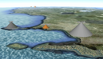
Cones: Create maps which illustrate X,Y locations with upward- or downward-facing cones. The size and color of the cones can be constant OR based on specific size and color listings in the datasheet. (More info)
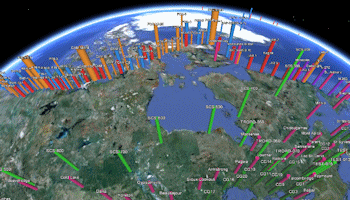
Cylinders: Create maps which illustrate X,Y locations with 3D cylinders. The size and color of the cylinders can be constant OR based on specific size and color listings in the datasheet. (More info)
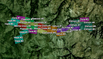
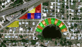
Mining Claims: This program plots simple quadrilateral polygons based on 4 pairs of corner point coordinates read from the datasheet. The claim blocks are plotted with a variety of display and filtering options. (More info)
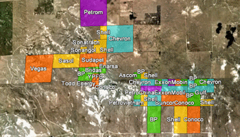
Oil & Gas Leases: This program plots simple quadrilateral polygons based on Public Land Survey data. The leases are plotted with a variety of display and filtering options. This requires that you have installed the RockWare Landbase. (More info)
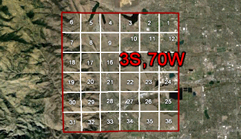
Public Land Grid: Plot one or more township grids based on the RockWare Landbase. (More info)
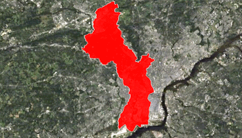
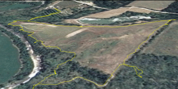
Polygon - Single: Read a listing of XY vertex coordinates from the datasheet, and a single polygon is drawn between these coordinates. Flat or extruded polygons are available. (More info)
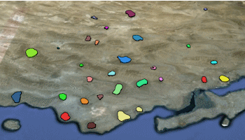
Polygons - Multiple: Vertex coordinates for multiple polygons are listed in external files, whose names are listed in the datasheet. A variety of color and elevation options are offered. (More info)
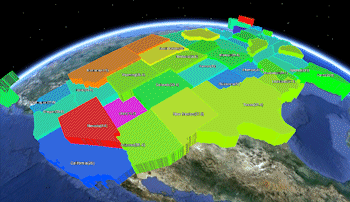
Predefined Polygons: Read a list of state or country names and measured values from the datasheet, and create a polygon map with a variety of color and elevation options. (More info)
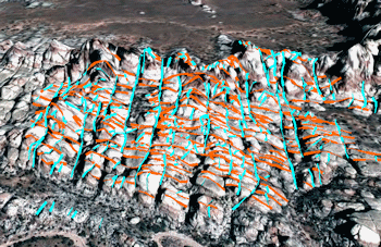
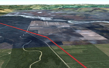
Lines: Lines are plotted between X1Y1, X2Y2 endpoints in 2D or 3D, in constant or variable colors. with the lines plotted along the ground, relative to the ground, or at a fixed elevation. Lines can be "extruded" down to the ground like fence panels. (More info)
Polyline - Single: Plot a single polyline in Google Earth, with XY and (optionally) Z coordinates read from the datasheet. (More info)
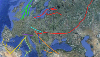
Polylines - Multiple: Plot multiple polylines, read from individual XY(Z) files. (More info)
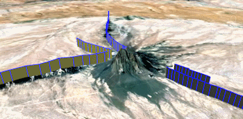
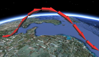
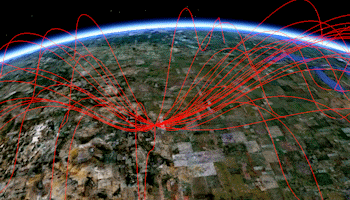
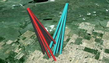
Parabolic Arrows: Plot one or more multi-segmented 3D parabolas, drawn as 3D arrows, between two geographic locations (X1Y1, X2Y2) read from the datasheet. (More info)
Parabolic Lines: Plot one or more multi-segmented 3D parabolas, drawn as continuous polylines, between two geographic locations (X1Y1, X2Y2) read from the datasheet. (More info)
Parabolic Tubes: Plot one or more multi-segmented 3D parabolas, drawn as continuous tubes, between two geographic locations (X1Y1, X2Y2) read from the datasheet editor. (More info)
Pipeline - Single: Plot a single multi-segmented 3D pipeline, with XY coordinates read from the datasheet. (More info)
Pipelines - Multiple: Plot multiple 3D pipelines, read from individual .rwDat files which list XY coordinates. (More info)
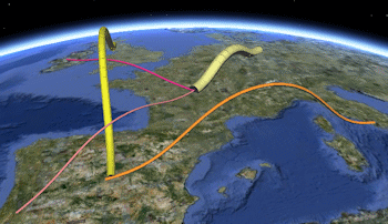
Tubes: Tubes are drawn between the X1Y1Z1, X2Y2Z2 endpoints in 3D, using fixed or variable colors and thicknesses, along the ground, relative to the ground, or at a fixed elevation. Tubes differ from Pipelines by allowing elevation definitions. (More info)
Survey Points: Read bearing and distance measurements, convert to XY points based on defined control points, and generate a point map. (More info)
Survey Polygons: Read bearing and distance measurements, convert to XY polygon vertices based on defined control points, and generate a polygon map. (More info)
![]() Back to Utilities Summary
Back to Utilities Summary
"Google" is a trademark of Google Inc.
![]()