What is the RockWare LandBase?
The RockWare LandBase contains Public Land Survey System (PLSS) reference data from a variety of public sources.* The LandBase database is used to convert locations which are defined with Range, Township, and Section descriptions into XY coordinates, and to generate maps representing section lines and lease blocks for output to Google Earth or RockPlot2D.
How do I get the RockWare LandBase?
The RockWare LandBase dataset is available for download from the RockWare web site via the RockWorks Help | Downloads window. Look for the "RockWare LandBase Version 2" grouping. **
The LandBase files large (from 143mb to 351mb!) thereby requiring some time to download from the RockWare website. Be sure to download all of the LandBase files in the grouping (e.g. all 8 of 8), which will be saved to the RockWare system folder. (Note that you can change the default location of the LandBase files during the original installation of the RockWorks program.)
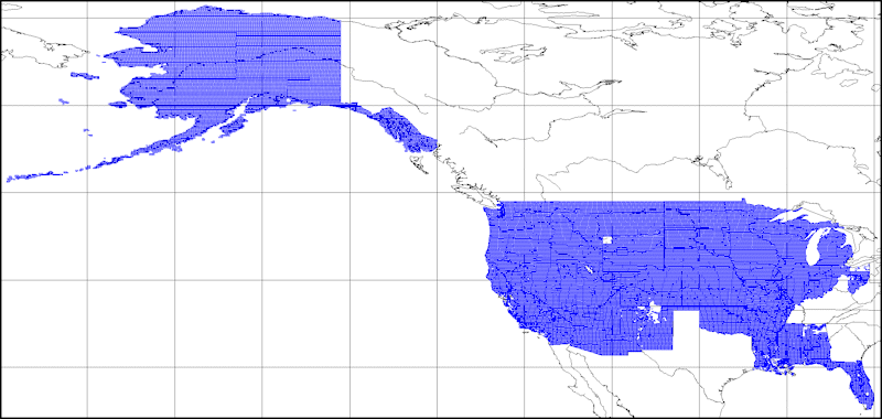
How much of the US is coved by the RockWare LandBase?
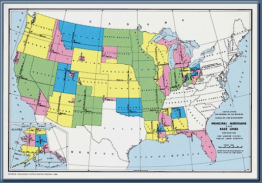
The entire U.S. is not covered by the RockWare LandBase. How do you know whether your project area is covered? You can refer to the following maps. First, look at this map to determine if there is a named principal meridian in the area in which you are working (you can click on a portion of the map to bring up an enlargement).
This map represents the current coverage of the LandBase data:
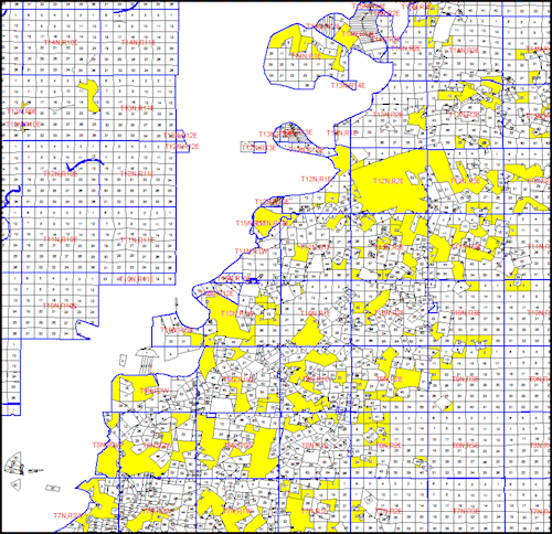
Note: Utilities such as well-spotting and lease-plotting may produce unpredictable results when dealing with sections that are convex polyhedra. For example, consider the hodgepodge of sections (below) within southern Louisiana. The polygons that have been shaded yellow represent examples of problematic sections.
Definitions
In the US Public Land Survey System, a Principal Meridian is a north-south line dividing ranges into east and west. Its Baseline is the east-west line that divides townships between north and south. Where the Principal Meridian and Baseline meet is the point of origin of the land survey.
* The LandBase (Public Land Survey Range,Township,& Sections) database has been updated to include data for all of the Public Land Survey meridians based on BLM, USDA, USFS, etc. data. RockWare makes no warrantees, guarantees, etc. in regards to the accuracy of the data.
** The structure for the LandBase files and associated programs changed as of January 2011. For RockWorks versions newer than 2011.1.24, you should download the "RockWare LandBase New" group of 8 files from the RockWare web site via the Help | Downloads menu.
![]()