Use the programs in the RockWorks Utilities menu to read a variety of data from the Datasheet Editor, and generate maps, Google Earth output, miscellaneous structural or chemistry diagrams, compute statistics, convert coordinates, and much more. These tools are summarized below. Click on the links or images to jump to the topic.
![]() Back to RockWorks Introduction
Back to RockWorks Introduction
Quick Links:
2D Maps - 3D Maps - Google Earth Maps - Hydrology Tools - Hydrochemistry Tools - Linear Tools
Planar Tools - Statistical Tools - Survey Tools - Coordinate Tools - Widgets
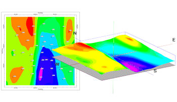
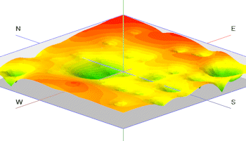
2D Maps: Read spatial data from the RockWorks Datasheet, and generate a variety of different maps - points, contours, polygons, 3D points, and more.
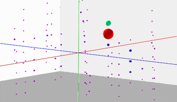
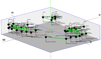
3D Diagrams: Read spatial data from the RockWorks Datasheet and generate a variety of 3D diagrams - 3D points, infrastructure, shapes, and more.
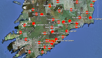
RockWorks Earth Tools: Read spatial data from the Datasheet and create a variety output for Google Earth.
Hydrology Tools: Compute water level drawdown, plot pathlines, create hydrograph diagrams.
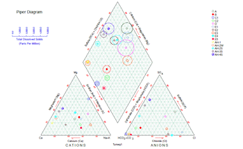
Hydrochemistry Tools: Read ion concentration data from the datasheet, generate a variety of different diagrams, and perform a variety of computations
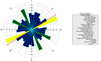
Linear Tools: Read line endpoint or bearing data from the datasheet, generate a variety of different diagrams, and perform computations.
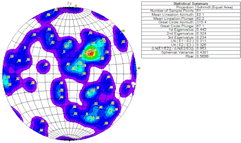
Planar Tools: Read strike and dip data from the datasheet, generate a stereonets, strike and dip maps, structure maps, and perform a variety of computations
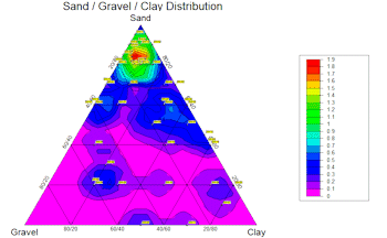
Statistical Tools: Read measurements from the datasheet and compute basis statistics, create frequency histograms, scatterplots, ternary plots, sieve diagams, and more.
Survey Tools: Generate reports, 2D and 3D maps from survey data.
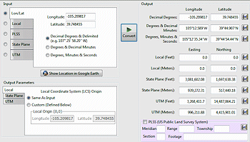
Coordinate Tools: Convert coordinates from a variety of systems.
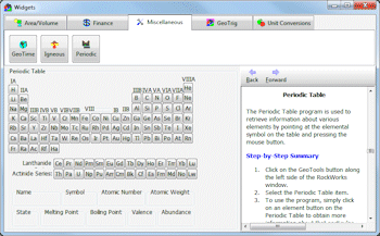
Widgets: Miscellaneous program calculators and reference tools
![]() Back to RockWorks Introduction
Back to RockWorks Introduction
![]()