Use the programs in the Utilities | Coords menu to perform a variety of coordinate conversions on data listed in the RockWorks datasheet or typed into the program window. This topic summarizes the tools that are available - click on a link for more information.
![]() Back to Utilities Summary
Back to Utilities Summary
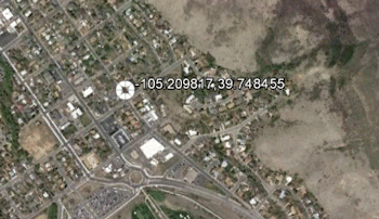
Quick Locator: Reads a single XY coordinate pair that you type into the program prompt and displays the point with a symbol in Google Earth. (More info)
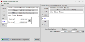
Convert Single Point: Translates a single coordinate pair from one coordinate system to another. (More info)
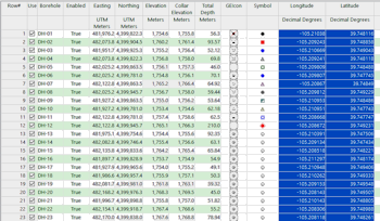
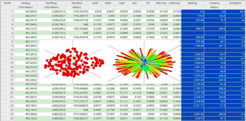
Convert Multiple Points: Translates multiple coordinate pairs listed in the datasheet from one coordinate system to another. (More info)
Polar -> XY: Translates location coordinates listed in a polar coordinate format (bearing and distance) to X,Y coordinates in a Cartesian coordinate format, assuming a fixed reference point. (More info)
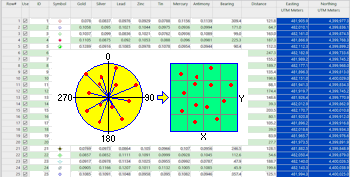
XY -> Polar: Translates X,Y locations in a Cartesian coordinate format to a polar coordinate format (bearing and distance) assuming a fixed reference point. (More info)
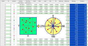
XYZ -> Polar: Converts a list of xyz coordinates into a borehole-style list of polar coordinates (i.e. distance, bearing, inclination). (More info)
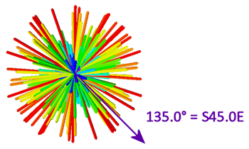
Azimuths -> Quadrants: Translate decimal-style azimuth bearings (i.e. 135) into quadrant-style bearings (i.e. S45E). (More info)
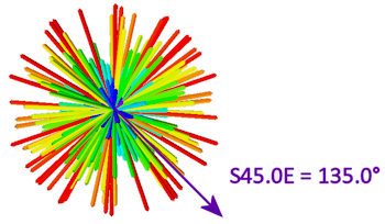
Quadrant -> Azimuth: Translate quadrant-style bearings (i.e. S45E) into decimal-style azimuth bearings (i.e. 135). (More info)
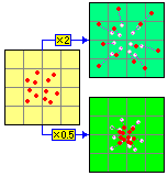
Rescale XY Data: Rescale X,Y location coordinates by a user-declared real number value. (More info)
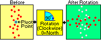
Rotate XY Data: Rotate X,Y location coordinates by a user-declared amount around a user-declared "pivot" point. (More info)
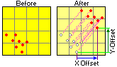
Shift XY Data: Shift the X,Y location coordinates by a user-declared amount in both the X and Y directions. (More info)
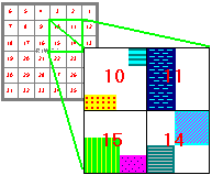
Public Land Survey -> XY: Computes X,Y coordinates for each corner of leases that are listed with Range, Township, Section descriptions. (More info)
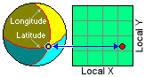
Local Origin Lon/Lat: Compute the 0,0 lon/lat point for a local coordinate system, given a known point. (More info)
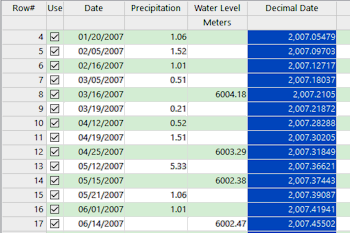
Dates -> Stardate: Translate dates into a decimal-style "stardate". (More info)
Merge Time-Stamped GPS Data: Compute X,Y coordinates to datasets that only have a "timestamp" using a GPS file. (More info)
![]() Back to Utilities Summary
Back to Utilities Summary
![]()