RockWorks | Utilities | Coords | Convert Multiple Points
This program is used to convert a listing of X,Y location coordinates in the datasheet from one coordinate system to another.
See Converting Single Coordinates if you need to convert a single point only.
Menu Options
Step-by-Step Summary
- Input
- Input Coordinates and Units: Click on the tab representing the coordinate system for the input data which are to be converted. For example, if the input columns (specified next) contain UTM Eastings and Northings, you would would click on the UTM tab.
Specify the other input parameters for that coordinate system, such as units (e.g. feet or meters), zone, etc.
- Data Columns: The specific prompts will change depending on the selected input coordinate system, above. For each prompt, choose the name of the column in the current datasheet that contains the listed coordinates, which you wish to convert.
- Output
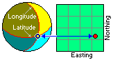
- Output Coordinates and Units: Click on the tab representing the coordinate system to which the input data are to be converted. For example, if the input data are to be converted to longitude and latitude coordinates, you would click on the "Lon/Lat" tab.
Specify the other output parameters:
- Lon/Lat: Choose how you want the output coordinates to be formatted - decimal degrees, degrees and decimal minutes, etc.
- Local: If you wish to convert to Local coordinates, you can enter a known longitude and latitude point for the local system origin, and choose the output units.
- PLSS: If you are converting to this system, be sure that you have downloaded the RockWare Landbase, which is the reference library for the Public Land Survey data.
- SPC: For State Plane Coordinate output, choose the State Plane Zone and select the units (feet or meters).
- UTM: For UTM output, choose the Datum and Zone, and select the units (feet or meters).
- Other: Click the Set Projection button to choose another coordinate format for output. Each will have its own required settings (ee Custom Coordinates for more information). Choose the output units.
- Data Columns: The specific prompts will change depending on the selected output coordinate system, above. For each prompt, choose the name of the column in the current datasheet into which the converted coordinates are to be recorded.
! Any existing data will be overwritten.
- Access the RockWorks Datasheet program tab.
- Open or create a data file containing the map coordinates to be translated.
- Select the Utilities | Coords | Convert Multiple Points menu option.
- Enter the requested program settings, described above.
- Click the OK button when all of this information has been entered.
The program will read the input coordinates and convert them to the selected output format, storing them in the selected columns. The selected units will be shown in the second header line.
 Back to Coords Menu Summary

RockWare home page