RockWorks | Utilities | Coords | XYZ->Polar
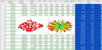
This program is used to convert a list of xyz coordinates into a borehole-style list of polar coordinates (i.e. distance, bearing, inclination). This program is intended for occasions when you might need to treat a list of XYZ points as a borehole (i.e. converting the data into the Borehole Manager orientation table). The resulting coordinates are stored in two columns in the main datasheet.
Menu Options
Step-by-Step Summary
- Data Columns
- Input: Specify the columns in the current datasheet which contain the input data.
- X (Easting): Select the name of the column that contains the existing X (Easting) Cartesian coordinates to be translated.
Be sure you define your coordinate system and units. See Defining your Datasheet Coordinates for more information.
- Y (Northing): Select the column that contains the existing Y (Northing) Cartesian coordinates to be translated.
- Z (Elevation): Select the name of the column in the datasheet that contains the Z or elevation coordinates to be translated. Be sure you have defined the linear units (feet or meters) for this column.
- Output: Declare the columns for the computed coordinates using these prompts. Any existing data in these columns will be overwritten.
- Distance: Select the name of the column in the current datasheet into which the computed distance measurements are to be recorded.
- Bearing: Select the column into which the computed bearing (0 to 360 degrees) are to be recorded.
- Inclination: Select the name of the datasheet column into which the computed inclination measurements are to be recorded. RockWorks will use a convention in which "0" represents a horizontal line, "-90" points straight down, and "90" points straight up.
- Conversion Parameters
- Decimals: Click on the Decimal Places item to specify the number of decimal places for the output distance, bearing, and inclination measurements.
- Access the RockWorks Datasheet program tab.
- Create a new datasheet and enter or import the X Y Z coordinates, in a Cartesian coordinate system, to be translated.
Or, open one of the sample files and replace that data with your own. See Data Layout for datasheet examples.
! Click the Example button at the top of the window to load a sample file that is installed with the program.
- Select the Utilities | Coords | XYZ -> Polar menu option.
- Enter the requested program settings, described above.
- Click the Continue button to proceed.
The program will convert the source X,Y,Z coordinates to a polar format as specified and store them in the selected columns in the datasheet.
 Back to Coords Menu Summary

RockWare home page