Use the programs in the Graphics | 2D Tools menu to manipulate RockPlot2D images (maps, cross sections, diagrams) such as rescaling, reassigning coordinates, importing, and exporting. These programs are also present in RockPlot2D; they are offered here as a means of adding the programs to the Playlist. This topic summarizes the tools that are available - click on a link for more information.
![]() Back to Graphics Menu Summary
Back to Graphics Menu Summary
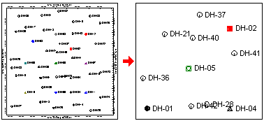
Clip: Extracts from an existing map or diagram all of the contents that lie within a user-declared rectangular area. (More info)
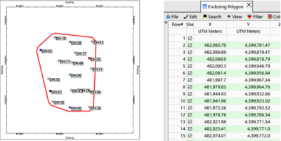
Enclosing Polygon: Compute XY coordinates for a convex polygon that encloses a list of XY points or enabled boreholes. (More info)
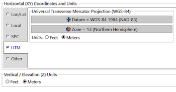
Reassign Projection: Assigns the coordinate system and units which are stored in a RockPlot2D map or cross-section diagram. (More info)
Montage: Rescales (if necessary) and combines multiple RockPlot2D files (*.Rw2D) into a single "montage," using coordinate information that you enter into the RockWorks datasheet. (More info)
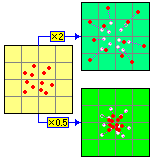
Rescale: Rescales X,Y location coordinates in a graphic image using either new origin coordinates and scaling multipliers or new coordinates entered for one or more boundary edges. (More info)
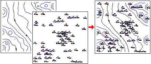
Append 2D Files: Combines the contents of two RockPlot2D files (*.Rw2D) for display as a new, combined image. (More info)
Import: Import a variety of file types and save a RockPlot2D diagram.
AGL: Imports labels, symbols, lines, and polygons from an AGL file into RockPlot2D.
DLG: Import USGS Digital Line Graph data into the RockPlot2D window.
DXF: Imports the contents of a DXF (AutoCAD-compatible Data eXchange) file into the RockPlot2D program for display as a plan-view image.
Shape: Imports point, line, or polygon data from ESRI Shapefiles for display in RockPlot2D.
Export: Export a variety of file types from RockPlot2D.
Raster: Saves an existing Rw2D image in a BMP, JPG, PNG, TIF format.
DXF: Saves an existing Rw2D image in a DXF format.
WMF: Saves an existing Rw2D image in a WMF format.
EMF: Saves an existing Rw2D image in an EMF format.
KMZ: Saves an existing RockPlot2D map or diagram as a Google Earth KMZ file: Charts, Maps, Sections, and Vertical Charts.
PDF: Save an existing RockPlot2D map or diagram to PDF: One file or multiple files.
RockPlot3D: Displays an existing Rw2D map in RockPlot 3D, either draped over a grid model or floating at a particular elevation
ReportWorks: Displays an existing RockPlot2D map or diagram in the ReportWorks program.
Shape: Export an existing RockPlot2D map to an ESRI Shapefile format.
MapInfo: Export an existing RockPlot2D map to a MapInfo MIF format.
![]() Back to Graphics Menu Summary
Back to Graphics Menu Summary
![]()