Use the tools in the Utilities | Survey menu to perform a variety of survey-related operations. This topic summarizes the programs that are available - click on a link or picture for more information.
![]() Back to Utilities Summary
Back to Utilities Summary
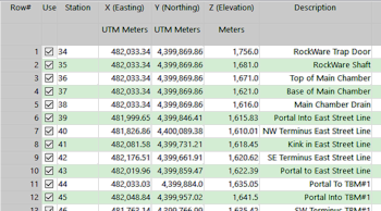
XYZ: Read survey data (in a bearing, inclination, distance format) from the datasheet and calculate XYZ coordinates. (More info)
Map: Read survey data (in a bearing, inclination, distance format) from the datasheet and display the control points, survey points, and traverse lines in a 2D map. (More info)
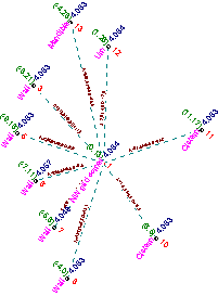
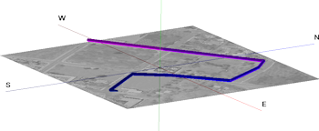
3D: Read survey data (in a bearing, inclination, distance format) from the datasheet and display the control points, survey points, and traverse lines in a 3D scene. (More info)
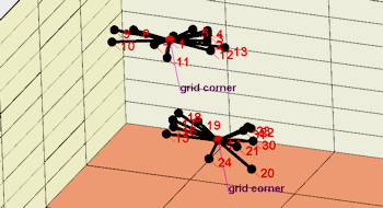
Panels: Read survey data (in a bearing, inclination, distance format) and 4 station points from the datasheet and display the panels in a 3D scene. (More info)
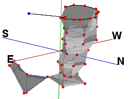
Tubes: Read survey data (in a bearing, inclination, distance format) from the datasheet and display the traverse lines as tubes in a 3D scene. (More info)
Triangulation: Convert triangulation survey data to XYZ coordinates for recording in the current datasheet. (More info)
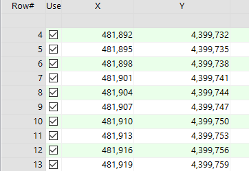
Setup XY Stations: Create a new set of X,Y coordinates based on a single user-entered coordinate, a known grid-based station arrangement, and a user-entered spacing. (More info)

Interpolate Points On Line: Creates a new set of X,Y coordinates based on beginning and ending coordinates of a line, and the point spacing along that line. (More info)
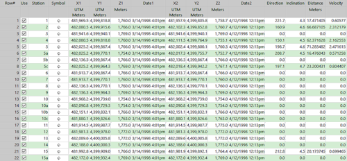
Movement Analysis: Determine the direction, inclination, distance, and velocity for X, Y, Z and time data. (More info)
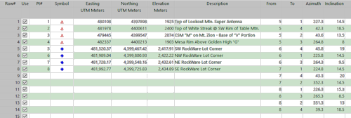
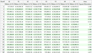
Mining Claim Area: Read a listing of XY corner points from the datasheet, compute the area represented within each claim block, in the project output units, and record these measurements into the designated column in the datasheet. (More info)
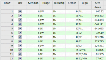
Oil Lease Area: Read a listing of lease descriptions from the datasheet, compute the area represented within each lease using the RockWare Landbase, and record these measurements into the designated column in the datasheet. (More info)
![]() Back to Utilities Summary
Back to Utilities Summary
![]()