RockWorks | Utilities | Survey | Interpolate Points on Line
This program is used to create a new set of X,Y coordinates based on beginning and ending coordinates of a line, and the point spacing along that line (e.g. seismic shotpoints).
Feature Level: RockWorks Basic and higher
Menu Options
Step-by-Step Summary
- Data Columns
- Output
- X (Easting): Select from the drop-down list the name of the column in the main datasheet into which the computed X coordinates are to be listed. Any existing data will be overwritten.
- Y (Northing): Select the column into which the computed Y coordinates are to be listed. Any existing data will be overwritten.
- Point Data
- Starting Point X, Starting Point Y: Type into these prompts the X and Y coordinates for the starting point of the line.
- Ending Point X, Ending Point Y: Type into these prompts the X and Y coordinates for the ending point of the line. The intermediate points will be computed between these lines.
- Starting Row, Ending Row: Click on these items to specify the number for the row in the datasheet into which the program-computed coordinates are to start, and to end. This tells the program how many stations you want to compute between the known beginning and ending coordinates.
- Decimal Places: Enter here the number of decimal places to be represented in the computed X and Y coordinates.
- Access the RockWorks Datasheet program tab.
- Create a new blank datasheet using the File | New | Blank menu option. Or create a new datasheet using a data template which has the X, Y, and ID columns already defined (File | New | Use Template).
- Select the Utilities | Survey | Interpolate Points on Line menu option.
- Enter the requested menu items, described above.
- Click the Continue button to proceed.
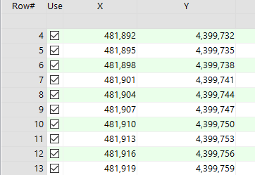
The program will compute the X,Y location of regularly-spaced sampling sites along the given line, and store them in the requested columns and rows in the main datasheet.
Tip: Once the program has computed the X,Y coordinates for the stations, select a symbol and color for each station. Then, you can create a simple point map of the locations using Map | Point Symbols.
 Back to Survey Menu Summary

RockWare home page