RockWorks | Utilities | Survey | Triangulation
This program is used to convert triangulation survey data to XYZ coordinates for display in the current datasheet. This program requires that two or more stations have known X,Y and Z (elevation) coordinates from which other coordinates can be computed.
Menu Options
Step-by-Step Summary
- Input Columns: Select the input data columns.
- Station Number: Select from the drop-down list the name of the column in the main datasheet that lists the station number. These must be unique numbers for each station so that the program can keep them all straight.
- Easting (X), Northing (Y): For these prompts, select the names of the columns in the main datasheet in which the known control point coordinates are listed. These will also be the columns in which the computed coordinates for the survey points are listed when processing is complete. Be sure you have your coordinate system and units defined.
- Elevation (Z): Select the name of the column in the main datasheet that lists the elevations for the known control points. This will also be the column in which the computed elevations for the survey points are listed when processing is complete. Be sure you have your elevation units defined (see Column Setup).
- From, To: Select the names of the columns in the datasheet that list the station numbers from and to which the measurements refer.
- Azimuth: Select the column containing the azimuth bearings from the "From" station to the "To" station.
- Inclination: Select the column containing the inclination measurements.
- Directionality: Choose how the directional data are recorded in the datasheet.
- Declination
- Magnetic Declination Correction: Enter any declinaton correction as described in the program dialog.
- Inclination: Select the format of the inclination measurements you have entered. Choose from:
- Up = 90 Degrees, Horizontal = 0 Degrees, Down = -90 Degrees
- Up = 0 Degrees, Horizontal = 90 Degrees, Down = 180 Degrees
- Access the RockWorks Datasheet program tab.
- Create a new datasheet and enter or import your triangulation survey data to be processed.
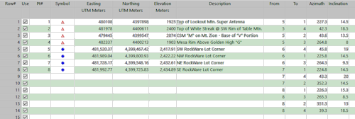
Or, open one of the sample files and replace that data with your own. This data must include the X,Y, and Z (elevation) coordinates for two or more known "control points" and two or more "sightings" listing the bearing and inclination to the control points for each station for which X,Y,Z coordinates are to be computed. See Data Layout for datasheet examples.
! Click the Example button at the top of the window to load a sample file that is installed with the program.
- Select the Utilities | Survey | Triangulation menu option.
- Enter the requested menu settings, described above.
- Click the Continue button to proceed.
The program will read the declared X,Y,Z locations of the known control points from the main datasheet. It will then read the indicated number of sightings for the survey stations, and compute their X,Y,Z coordinates using the listed bearings and inclinations. The computed coordinates will be stored in the Easting (X), Northing (Y), and Elevation (Z) columns in the current datasheet.
Tip: Once the program has computed the X,Y,Z coordinates for the survey stations, select a symbol and color for each survey station. Then, you can create a simple point map of the locations using Map | Point Symbols.
 Back to Survey Menu Summary

RockWare home page