The Borehole Manager Location table is used to enter well ID's, locations, surface elevations, depth ranges, and well symbols (all required), plus a variety of optional fields. The required location data is used to determine the position of the boreholes in the project and can be used to establish the project dimensions.
- Access the Borehole Manager program tab.
- Create a new project as necessary.
- Create a new borehole (if necessary), import your borehole data (if necessary), or click on the existing borehole to be edited.
- Click on the Location tab for the well.
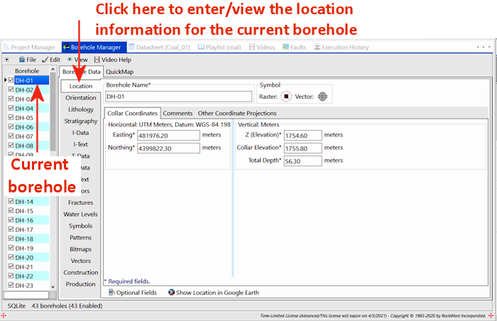
If the Location tab is not visible, you can use the scroll bar at the bottom of the tab column to scroll upward through the tab names.
- Required Fields:
- Borehole Name - Each borehole must have a unique name.
- Horizontal Coordinates - The X and Y (Easting, Northing) coordinates for the borehole
- Vertical Coordinates - The surface elevation, collar elevation, and total depth for the borehole
- Symbols - Vector and Raster symbols are required for each borehole
- Comments - This is an optional "memo" field, available in the Comments tab of the Location table, where you can store a variety of reference information.
- Other Coordinate Projections - The XY coordinates for the borehole in another coordinate system (such as longitude/latitude, PLSS).
- Optional Fields - The Location table is fully customizable; user-created fields can be added to this tab or to new, user-created tabs
 Back to Data Introduction

RockWare home page