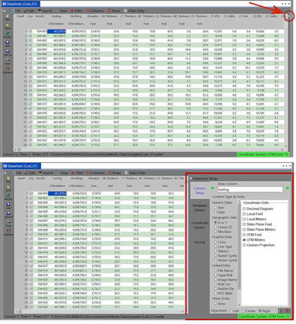
- Access the Column Setup pane on the right side of the datasheet. You can do this in several ways:
- By expanding the Datasheet Setup pane:
-
- By selecting the Columns | Column Properties menu option.
- By right-clicking on the column heading and selecting Column Properties from the pop-up menu.
- Set up the column titles and units. Use the green arrows to access previous/next columns. For your map X and Y columns, set them to "X or Y" and then choose the coordinate units.
-
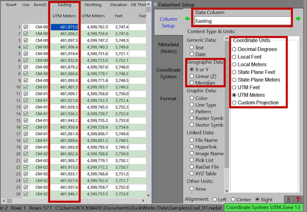
See Changing Column Titles, Styles, and Units for details.
- Click on the Coordinate System tab.
- Define the projection information. (See Coordinate Systems for more details.)
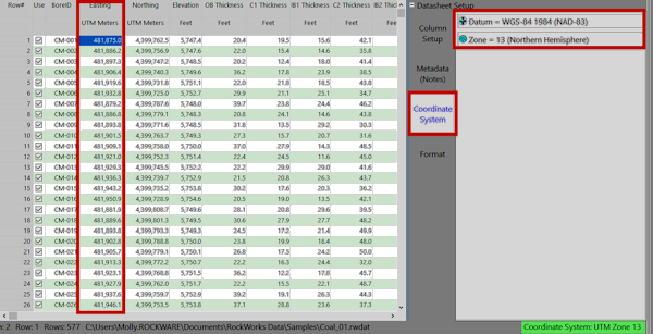
- For UTM coordinates, you'll need to define the Datum and the Zone.
- For State Plane coordinates, you'll need to define the Zone.
- For Local coordiantes, you'll need to define the reference longitude and latitude, if known. (If not known, just set these to 0 and 0.)
- If you have chosen a Custom Projection, use the Custom Parameters button to set up projection details.