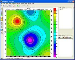
RockPlot2D is the plotting program for 2-dimensional RockWorks graphics, such as plan-view maps, 2D cross sections, and miscellaneous diagrams (ternary plots, etc.). Whenever a diagram like this is created, it can be plotted automatically in a RockPlot2D tab in the Options window. RockPlot2D can also be displayed as a stand alone window (not embedded in the Options window).
RockPlot contains many display, printing, and manipulation features. Choose a lesson by clicking on the link or arrow "![]() ".
".
![]() If this is the first lesson set you’ve done, please be sure you have (1) opened a project folder, and (2) restored the program defaults.
If this is the first lesson set you’ve done, please be sure you have (1) opened a project folder, and (2) restored the program defaults.
Open, "zoom" into, and combine maps.
Export the map and insert it into a document.
![]() Back to main tutorial menu
Back to main tutorial menu
![]()