RockWorks stores your database, data files, models, graphics, and other files for your work in specific folders called Project Folders. Each project stores its own settings which define spatial and other information about the site.
Where they are displayed: The project-related items are displayed at the top of the main program window.
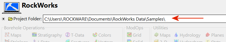
Project Folder: The name of the current Project Folder is displayed below the uppermost menu bar. See the Project Overview topic for information about creating and opening projects.
Project Settings: Expand the Project Settings are shown in an expanding/collapsing pane, using the small button to the left of the Project Folder name.
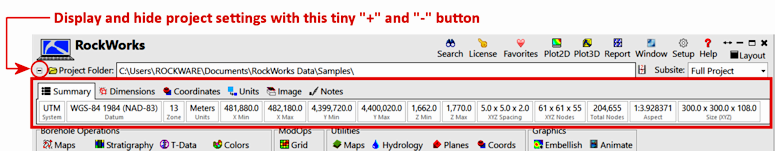
Here is a summary of the settings tabs which are available; click the links shown for more information.
- The Summary tab shows a summary of the coordinate system, units, dimensions and other statistics.
- The Dimensions tab is where the actual minimum and maximum coordinate values and node spacings are established, by scanning data or typing them in. The X, Y, and Z units are also displayed. (More info)
- The Coordinates tab displays the current project coordinate system. You can change the project coordinate system here, also. (More info)
- The Units tab is where you define volume, mass and area units for program calculations.
- The Image tab is where you can define a graphic image to be used as a layer in your maps and diagrams. (More info)
- The Notes tab is an RTF editor where you can put all manner of project notes. (More info)
Important:When using RockWorks, your XY units can be in meters and the Z unit can be in feet IN THE DATABASE, but model output (RockPlot3D files, maps, contours, etc.) is always in ALL FEET or ALL METERS (one or the other).
- Scenario 1: XY units are meters in the database and Z units are feet in the database, Output Units are meters.
- The Z values in the boreholes and in your RWDat files (which are in feet) are always converted to meters in model output.
- This includes your RockPlot3D models, as well as elevations in gridded surfaces and contour maps, as you found.
- In the Dimensions tab, the Z values should be assigned values different than the borehole elevations in the database because they will be in meters instead of feet. For example, your project, which had elevations values between 695 and 900 feet should have had values such as ~210 - ~275 meters.
- Cross-sections are also created with units of meters in both the XY and Z directions.
- Scenario 2: XY units are meters in the database and Z units are feet in the database, Output Units are feet.
- The XY values for boreholes, or points and profile endpoints in the RWDat files (which are in meters), are always converted to feet in model and map output.
- If you are plotting labeled axes around 2D Maps, these coordinates would be in feet instead of meters.
- In the Dimensions tab, the X and Y values should be assigned values different than the borehole Eastings/Northings in the database because they will be in feet instead of meters.
- Cross-sections are always created in feet.
- Global settings for information about settings which apply to all projects in RockWorks.

RockWare home page