Use this program to create a map showing saved transect locations from various programs. You can add and edit the labels, change the line colors, and show all or only some transects to use as an index map.
Feature Level: RockWorks Basic and higher
Menu Options
Step-by-Step Summary
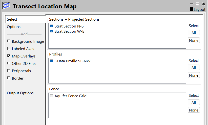
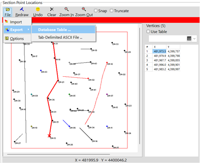
These Section/Profile/Fence items are populated from the Project Manager | Log/Section Tables. You need to save your sections there first. To do that from a menu with a Section Location you wish to save; define the section then click on File | Export | Database Table. Then you can select them to show on this map.
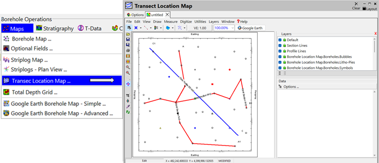
The program will generate a map with the selected section, profile, and fence locations shown.
If requested, it will create a 2-dimensional map containing the requested map layers. The map will be displayed in a RockPlot2D tab in the options window.
If requested, it will create a 3-dimensional map containing the reqested layers. The surface will be displayed in a RockPlot3D tab in the options window.
![]() Back to Map Menu - Summary
Back to Map Menu - Summary
![]()