RockWorks offers the following layer options for 3D surface maps. A layer will be generated if a check-mark is displayed in its check box. To access the item's setting, click on its tab in the RockWorks program window.
Click on a picture or link below for more information.
|
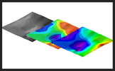
Colors: Choose the color scheme for the 3D surface |
| Flat Surface: Defines whether the surface is to be displayed with 3D relief or as a flat plane. | |
| Perimeter Skirt: Draws a skirt around the base of the 3D surface. | |
| Striplogs: Include 3D logs along with the 3D surface. | |
|
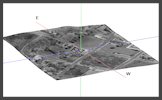
Draped Image: Display a raster image warped over a grid surface. |
| Floating Image: Display a raster image floating as a plane at a defined elevation. | |
| Perimeter Cage: Include coordinate labels and axis panels with the 3D scene. | |
| Legends: Include legends to patterns and colors. | |
| Infrastructure: Include a layer with 3D buildings, roads, pipes, and other infrastructure locations. | |
| Faults: Display fault ribbons in the 3D scene. | |
| Other 3D Files: Add up to 5 existing RockPlot3D files to your new scene. |
![]()