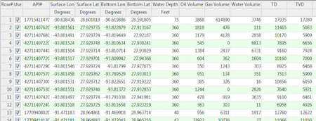
The RockWorks Datasheet is a spreadsheet-style data window designed for entering miscellaneous data - simple XY data for creating Google Earth maps, XYZ data for generating point and contour maps, strike and dip data for stereonet plots, hydrochemistry ion lists for Piper diagrams, and many more. This is a simplified datasheet that operates much like other general spreadsheet applications.

The datasheet is saved in text format with the file name extension ".RwDat". The column headings, column styles (text or symbols or lines), coordinate system (e.g. UTM or lon/lat), and units (feet or meters) are stored in a header block at the top of the file. See RwDat File Format for details.