If you wish to plot individual points on a RockWorks Sphereplot map, you simply need to enter the global coordinates for the points in two columns in the main RockWorks datasheet. This example illustrates global points in longitude and latitude, and additional information.
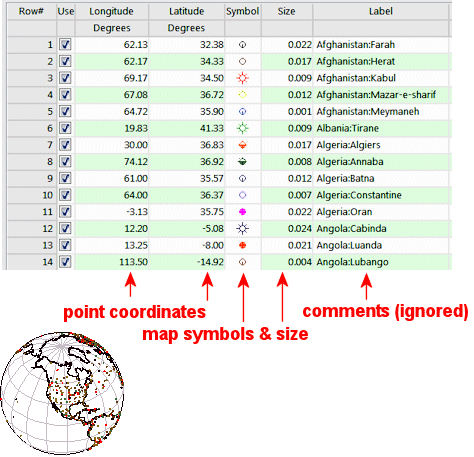
- X and Y Coordinates: Required. The program must have location coordinates in order to plot the points on the global map. These must be listed in global coordinates; see Defining your Datasheet Coordinates and Units for information.
- Symbols: Optional. You can declare specify symbols and colors for specific sites.
- 3-D_Sphereplot_Cities.RwDat

RockWare home page