RockWorks | Utilities | EarthApps | Extract Menu
Use the programs in the Utilities | EarthApps | Extract menu to read location data that has been copied from or saved from Google Earth, and list the coordinates in the Utilities Datasheet. This provides an easy method for capturing coordinates from shapes drawn in Google Earth. This topic summarizes the programs that are available - click on a link or picture for more information.
Table of Contents
| Points | Lines | ||||
| Polylines Single (All Points) | Polylines Multiple (1 File per Polyline) | ||||
| Polygons Single (All Points) | Polygons Multiple (4 Points Each) | Polygons Multiple (1 File per Polygon) | |||
![]() Back to EarthApps Summary
Back to EarthApps Summary
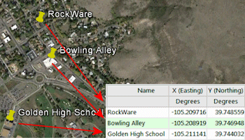
Points: Extract X and Y point locations from Google Earth placemarks.
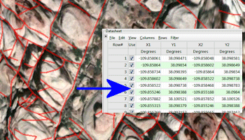
Lines: Extract line endpoint locations from Google Earth.
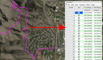
Polylines - Single (All Points): Extract vertex coordinates for a single polyline, and list them in the datasheet.
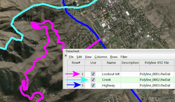
Polylines - Multiple (One File per Polyline): Extract vertex coordinates for multiple polylines in Google Earth, create a separate RwDat file for each, and list those file names in the datasheet.
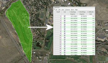
Polygons - Single (All Points): Extract vertex coordinates for a single polygon, and list them in the datasheet.
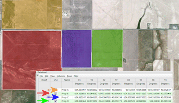
Polygons - Multiple (4 Corners Only): Extract vertex coordinates for a multiple polygons in Google Earth, and list their corner points in the datasheet.
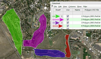
Polygons - Multiple (1 File per Polygon): Extract vertex coordinates for a multiple polygons in Google Earth, create a separate RwDat file for each, and list those file names in the datasheet.
![]() Back to EarthApps Summary
Back to EarthApps Summary
"Google" is a trademark of Google Inc.
![]()