The Borehole Manager database uses the Water Levels data table for entry of dates and depth intervals for one or more aquifers, for each borehole. These aquifers can be illustrated in strip logs, and they can be modeled for display as surface maps, fence diagrams, and more using the tools in the program's Aquifers menu.
The Aquifer Types Table defines for the program the names of the aquifers for the current project, the graphic pattern / color to use for each formation in logs and other diagrams, the order of the aquifers (upper to lower), and other items. It serves as the reference library for the downhole water level data. This table is stored in the project database and links to your water level data.
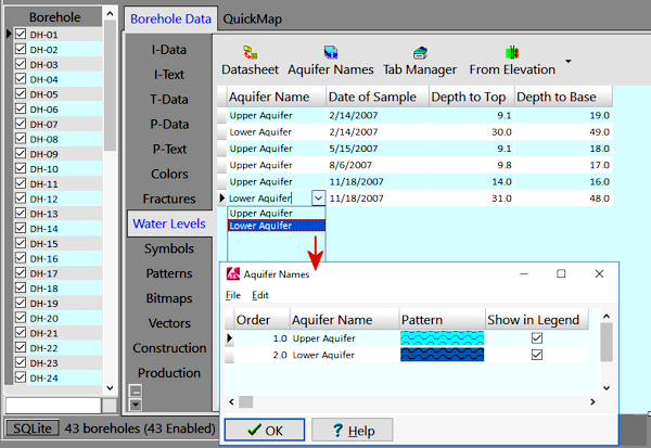
The Aquifer Types Table lists for each aquifer:
![]() Back to Tables summary
Back to Tables summary
![]()