RockPlot3D offers the following reference items in order to orient yourself in the current scene:
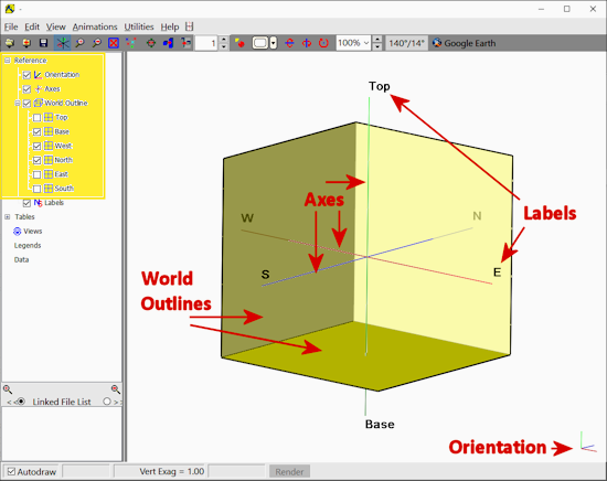
- Orientation marker: Displayed in the lower-right corner of the 3D View, it shows the current orientation of the X-axis (red), the Y-axis (blue), and Z-axis or elevation (green). If you rotate the display, the orientation marker will be updated.
- Axes: The X, Y, and Z (elevation) axes are plotted in the middle of the currently-defined scene dimensions.
- World Outlines: Expand this item to access individual reference grids for the Top, Base, West, North, East, and South boundaries of the scene. Right-click on any item to adjust the color, fill, and opacity of the reference grids. Choose View / Dimensions to adjust the scene dimensions.
- Axis labels, which note the Top, Base, West, North, East, and South directions.
These reference items are listed at the top of the listing in the data pane of the RockPlot3D screen. They are available for all 3D scenes.
 Back to RockPlot3D Overview

RockWare home page