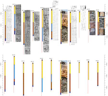
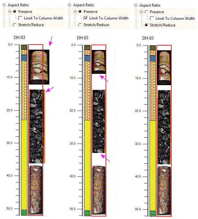
Use the Striplog Bitmaps check-box to plot downhole raster images in vertical 2D logs. These images can represent raster elogs, digital core photographs, etc. The image depths and names are read from the RockWorks Borehole Manager's Bitmaps data table. When you click on the Bitmaps item in the layout window you’ll see the following settings in the pane to the right.
Bitmap Column Options
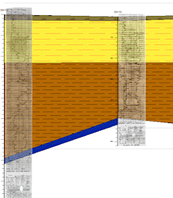
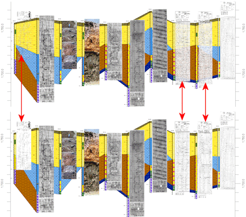
In the example shown here, the upper cross section was generated with All Types selected, and the logs display scanned elogs, core photos, outcrop photos - all images in the database for those boreholes. By contrast, the lower section was generated with the Outcrop Photos only.
See also:
![]() Back to 2D Striplog Options
Back to 2D Striplog Options
![]()