The Symbols layer is available for 2-dimensional maps and diagrams (e.g. stereonets). It is used to create a map layer that illustrates the sample locations with map symbols and other items. These settings are available by clicking on the Symbol Options button, present under the "Symbols" checkbox in many RockWorks Utilities menus.
Menu Options
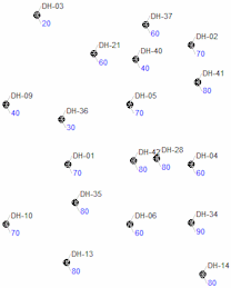
Uniform symbols, Fixed dimensions
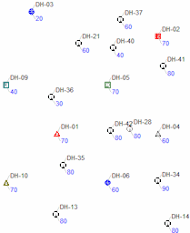
Column-based symbols, Fixed dimensions
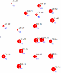
Circle symbols, Variable / Linear dimensions
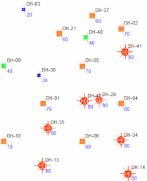
Table-based symbols (dimensions are defined in table)
See also:
![]()