
RockWorks | Utilities | EarthApps | Images | Drape Menu
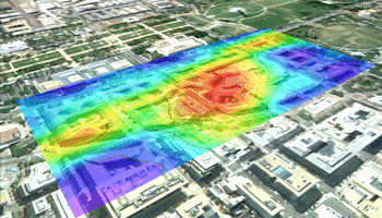
Use the programs in the Utilities | EarthApps | Images | Drape menu to read a listing of user-created raster images and locations from the Datasheet Editor and plot these images in Google Earth, draped over the earth surface.
Based on Single Midpoint: Images are plotted based on a single XY location and a defined width and height.
Based on Two Corner Points: Images are plotted based on coordinates defined for their southwest and northeast corners.

Time-Animation: Multiple images are displayed in Google Earth, in a date-based animation.
Raster Labels: Display textual labels as non-dynamic images.
![]() Back to EarthApps Summary
Back to EarthApps Summary
"Google" is a trademark of Google Inc.
![]()