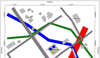
The Infrastructure layer is available as a Map Overlay for most RockWorks maps. It is used to read a list of entities such as buildings, roads, tanks, and walls and display them in a plan-view 2D map layer. The input for the 2D Infrastructure program consists of a text file that contains a series of objects and parameters.
 Infrastructure
Check this box to include a 2D infrastructure map as a layer with your other map(s).
Click on this tab to access the map settings.
- (ASCII) File: Click on this item to select the name of the user-created text file that contains the listing of infrastructure object and parameter commands.
- Entity Appearance: Choose Color-Filled for solid-filled objects, or Outline Only to display the object outlines with no fill.
- Plot Object Labels: Check this item to include object labels in the output map.
- Utilities | Maps | Infrastructure for a stand-alone version of this map type.

RockWare home page