RockWorks | Datasheet | Filter | Project Area
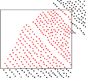
Use this program to filter data from the current datasheet based on the location of the sample inside or outside the current Grid & Model Dimensions. Points inside the project space remain enabled (checked), the data that do not meet the filter requirements will be unchecked (disabled).
For example, you could set a filter for the X and/or Y data columns to extract a spatial subset of a larger data file. Or, you could set a filter for a particular elevation range for a formation column.
! You may activate both an XY and an elevation filter. Note, however, that this operates as an "AND" filter, not an "OR" filter. That means that only those records that meet all of the filtering criteria will remain enabled.
! If the input coordinates are in a different coordinate system or represent different units than the project dimensions, they will be converted in background memory before the filtering operation occurs.
! Only rows which are already enabled (checked) will be processed by this filter. Disabled rows will remain disabled regardless of their data listings.
Menu Options
Step-by-Step Summary
- Data Columns: Use these prompts to define the input data columns.
- X (Easting): Select the column in the main datasheet that contains the X or Easting coordinates. This will be used if you activate the XY filter, below.
- Y (Northing): Select the column that contains the Y or Northing coordinates. As above, this will be used if you activate the XY filter.
- Z (Elevation): Select here the name of the column in the main datasheet that contains the numeric "Z" values representing elevation. This will be used if you activate the Z filter, below.
- Options
- Filter Based on XY Values: Insert a check here if you want to filter the data based on the X and Y coordinates in the datasheet, listed in the columns defined above. The program will compare the X and Y location of each sample (row) in the datasheet to the X and Y extents of the Grid & Model Dimensions.
- Horizontal Buffer Size: Use this setting to define a buffer zone which will be added to the Dimensions extents, thus enlarging the project area. You can enter either map units or a percent. For no buffer, enter 0.
! If you are creating maps of a subset of a larger project, adding this point buffer can help avoid the edge effects of gridding.
- Horizontal Map Units: Select this option if the Buffer Size you entered above represents actual map units.
- Percent of Diagonal Map Size: Select this option if the Buffer Size you entered above represents percent of the diagonal extents of the project.
- Filter Based on Z (Elevation) Values: Insert a check here if you want to filter the data based on the elevation values listed in the datasheet and defined in the Z column above. The program will compare the elevation of each sample in the datasheet to the Z extents of the project dimensions.
- Vertical Buffer Size: Use this setting to define a buffer zone which will be added to the Grid & Model Dimensions elevation extents, thus enlarging the project area. You can enter either vertical units or a percent. For no buffer, enter 0.
- Vertical Elevation Units: Select this option if the Buffer Size you entered above represents actual elevation units.
- Percent of Elevation Range: Select this option if the Buffer Size you entered above represents percent of the vertical extents of the project.
- Access the RockWorks Datasheet program tab.
- Open the datasheet to be manipulated.
- Click on the Filter menu above the datasheet and select the Project Area option.
- Enter the requested program settings, described above.
- Click the Continue button to proceed.
The program will read the enabled rows in the datasheet and (if necessary) convert the input coordinate system and units to match the Grid & Model Dimensions. It will determine those records whose XY coordinates fall within the Dimensions (if the XY filter is activated) and whose elevation values fall within the Dimensions (if the Z filter is activated), plus any defined buffer. These records will remain enabled in the datasheet. Those records which do not fall within the defined filter will be disabled.
 Back to Editing the Datasheet

RockWare home page