RockWorks | Graphics | Animate | Google Earth Flyovers | Spiral From Space
This program:
- Creates a flyover from space, zooming down to a specific XY location, with three circular passes, then zooming back out to space.
- Creates a KML output file containing the flyover.
- Creates a KMZ (zip) output file, containing the KML file.
- Loads the KMZ file in Google Earth.
See also
Simple Flyovers - Forward Facing
Simple Flyovers - Midpoint Facing
Feature Level: RockWorks Basic and higher
Menu Options
Step-by-Step Summary
- Tour Parameters
- Tour Title: Defines the flyover name.
- Midpoint: This defines the location where the flyover will focus.
- Longitude (Decimal Degrees): Type in the longitude coordinate for the flyover focus point. This needs to be entered in a "-112.12345" format (decimal degrees). Western longitudes are entered as negative values.
- Latitude (Decimal Degrees): Type in the latitude coordinate for the flyover focus point. This needs to be entered in a "35.12345" format (decimal degrees). Southern latitudes are entered as negative values.
! Tip: If you don't know the coordinates, just open Google Earth, locate the point of interest, point to it with your mouse, and notice the longitude and latitude coordinates represented in the Google Earth screen (typically at the bottom).
- Ground Elevation (meters): Here you need to enter the elevation, in meters, for this point. RockWorks will use this to know, automatically, how far to zoom in during the flyover pauses and circles.
! Tip: If you don't know the ground elevation, open Google Earth, locate the point of interest, point to it with your mouse, and notice the elevation that is displayed in the Google Earth window (typically at the bottom).
! Another Tip: If you prefer that the automatically-computed elevations for the pauses and circles be higher than the defaults, then set the ground elevation to a higher value.
- Project Radius (meters): For this prompt, enter the radius, in meters, around which the flyover should focus. For example, if you want the first circular pass to occur 1 KM out from the center point, then you would enter: 1000. The successive circular passes will occur at incrementally smaller radii.
- Group Name: Type in the name to assign to the flyover, which will be displayed in the Google Earth data tree.
- Output Options: Click on this tab to define the output file and display settings.
- Output File Name
- Automatic: Choose this option to have RockWorks assign the name automatically. It will use the name of the current program plus a numeric suffix, plus the ".KMZ" file name extension.
- Manual: Click this option to type in your own file name. The extension is ".KMZ".
- Display output within Google Earth: Check this box if you want to display the output at this time in Google Earth.
! Note that the actual program which will be used to display the KMZ file is determined by your Windows settings.
- Use Custom View: If unchecked, the starting viewpoint for the images will be determined automatically. If checked you can set a custom view.
- Longitude, Latitude: Type in the longitude and latitude coordinates where the viewpoint will be.
- Heading: Type in the 0 to 360 degree bearing from the viewpoint to the flyover start.
- Tilt: Type in the angle downward from the viewpoint to the flyover start.
- Range: Enter the distance in meters from the viewpoint to the flyover.
- Select the RockWorks | Graphics | Animate | Google Earth Flyovers | Spiral From Space menu option.
- Enter the program settings as described above.
- Click the Continue button to proceed.
The program will create a flyover path starting in space. It will descend to the ground elevation + 5 km, above your designated point, and hold. It will then descend to the ground elevation + 2 km and fly a circle at the project radius defined above. It will descend again, to the ground elevation + 1 km and fly the circle. It will then descend one more time and fly the circle at the ground elevation + 0.25 km. Finally, it will zoom back out to space.
It will create a KML file listing the generated flyover path, and a KMZ (zip) file containing the KML file. The Google Earth KML and KMZ file names will be assigned as you specified.
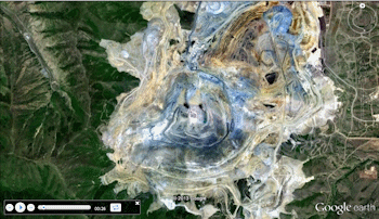
The resulting flyover will be displayed in Google Earth, if requested.
 Back to Animate Menu Summary
"Google" is a trademark of Google Inc.

RockWare home page