Borehole Survey files are read by the RockWorks | Borehole Operations | Striplogs | Datasheet -> Borehole Survey program. These files list the depth, direction, and inclination of the deviated borehole whose XYZ coordinates and log display the Survey program is designed to compute. These files conform to the same data format as the Borehole Manager's Orientation data table.
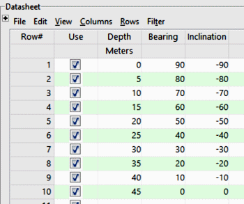
- Depth: This column contains the depth(s) at which downhole survey measurement(s) was made. Be sure to define the measurement units.
! The depth values must be positive.
- Bearing: This column lists the bearing of the well at this depth. (You can use the Tab key to advance from cell to cell.)
The bearings must be expressed in decimal azimuth degrees (0 to 360, with 0 = north).
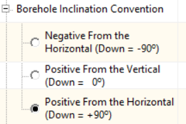
- Inclination: This column contains the inclination at this depth. RockWorks accepts the following inclination conventions, which you can specify in the program calculator window.
-
- You may list as many downhole survey locations as you wish. If you have an inclined drill hole, only one survey listing is needed.
- Survey data must be listed in a sequential order, from the start of the hole to the end.
- The "start" of the hole may be lower in elevation than the "end" of the hole if the boring curves back on itself.
- RockWorks uses an averaging method of drawing the drill hole trace based on the survey data in order to create smooth bends. Compare the following cartoons, based on the data shown. The hole on the left abruptly turns at a depth of 100 to follow the new survey inclination (not realistic) while the hole on the right curves to the horizontal dip at 100 feet.

- Striplogs_Borehole_Survey.rwDat

RockWare home page