These data files are typically imported into the RockWorks datasheet using the File | Import | SEG-P1 program. They can be represented as shotpoint maps using the Utilities | Maps | Seismic Shotpoints program.
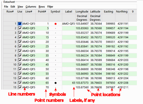
- Line Number: Required. The program uses the line number to determine which shotpoints are on which lines. During creation of a shotpoint map (Utiltiies | Map | Shotpoint) you can select which lines to display in the output map, based on line numbers.
- Point Number: Optional. Lists point number along the line.
- Symbol and color: Required if you wish to create a shotpoint map.
- Label: Optional, but handy if you wish to include point labels on the shotpoint map.
- X (Easting), Y (Northing) Coordinates: Required. RockWorks must have location information in order to create a shotpoint map. You can use either UTM coordinates or longitude and latitude coordinates.

RockWare home page