RockWorks | Utilities | File | Import | SEG-P1 Option
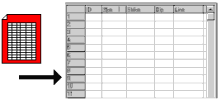
This program is used to import SEG-P1 style shotpoint data into the RockWorks data sheet. The program will read the selected SEG-P1 file and determine the points that lie on each seismic line. Each shotpoint will be listed with its line number in column 1. The program will determine the starting and ending points for each line, and list the selected symbols for these points in column 3. It will determine, for each line, the points that lie at the minimum distance you specified, and assign them the indicated symbols. All shotpoints between these labeled points will be assigned the symbols selected for "unlabeled points."
Feature Level: RockWorks Basic and higher
Menu Options
Step-by-Step Summary
- Input File: Browse for the SEG-P1 format data file to be imported.
- Import Options:
- Symbols: Select the graphic symbols to be used to represent the different shotpoint locations. You may select a different symbol for the starting point and ending point of the line. In addition, you may specify which intermediate points will be labeled and which will not be, based on the minimum distance declared below. You may select a different symbol for labeled versus not-labeled points. To select a symbol and color for any of the shotpoint types, simply click on the picture of the symbol and make a selection in the displayed window.
- Minimum Distance: Type into this prompt the minimum distance increment between shotpoint locations that are to include labels in the data manager (and subsequently in any map that's created). For example, if you were to enter "500", then the shotpoints at 500 unit (foot or meter) increments will include labels, and those in between will not.
- Save Datasheet File: Check this box to assign a name to the datasheet file that will be created for the import. If you do not check this box, it will simply be displayed as Untitled.
- Output File Name:
- Automatic: Choose this to have the name of the file assigned automatically, using the name of the program plus a numbering digit.
- Manual: Choose this option to type a preferred name for the RwDat file into the prompt.
- Access the RockWorks Datasheet program tab.
- Because the import program will create a new datasheet automatically, you should probably save any existing data currently displayed (File | Save).
- Select the File | Import | SEG-P1 menu option.
- Enter the requested menu settings, described above.
- Click on the Continue button to import the data.
The program will read the selected SEG-P1 file and determine the points that lie on each seismic line. Each shotpoint will be listed with its line number in column 1. The program will determine the starting and ending points for each line, and list the selected symbols for these points in column 3. It will determine, for each line, the points that lie at the minimum distance you specified, and assign them the indicated symbols. All shotpoints between these labeled points will be assigned the symbols selected for "unlabeled points."
 Back to Importing Data

RockWare home page