These files are used to display multiple images as horizontal panels in RockPlot3D. Supported image formats include: BMP, JPG, PNG, TIFF, GIF, WMF, EMF, PCX, PCC, TGA, AFI, VST, and ICO.
- File Name: Required. The images to be displayed in the panels must be in one of the graphic formats listed above. They must reside in the current project folder, along with the rwDat file in which they are listed.
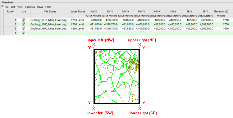
- Layer Name: Required. This will simply be used to label the panel in RockPlot3D.
- Lower-left X, Y: Required. These assign easting and northing coordinates to the lower-left corner of the raster image. These can be in meters or feet, in any supported coordinate format. See Defining your Datasheet Coordinates for more information.
- Upper-left X, Y: Required. These assigneasting and northing coordinates to the upper-left corner of the bitmap.
- Upper-right X, Y: Required. These assign easting and northing coordinates to the upper-right corner of the bitmap.
- Lower-right X, Y: Required. These assigneasting and northing coordinates to the lower-right corner of the bitmap.
- Elevation (Z): Required. This defines the elevation for each listed panel. Be sure to specify the units.
- Horizontal_Images_to_3D_Planes_01.rwDat

RockWare home page