These files are used to build a 3D image displaying particle flowpaths as tubes at specific XYZ locations, using the Utilities | Hydrology | Flowpath Tubes program. Most typically this type of file would not be generated by hand-entering the data, but instead by importing an ASCII Modpath Pathline File. (See Importing Modpath Pathline Data.) The Flowline program requires 5 columns of information: The path number, the X Y Z (elevation) location of the tube centers, and the color. Additional columns are optional.
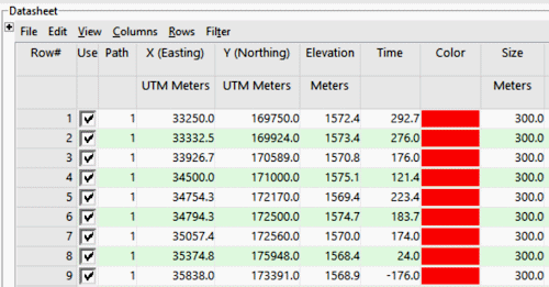
- Path: Required. The multiple points within individual flowpaths must be listed with the same number.
- X, Y, Z (elevation): Required. These assign easting, northing, and elevation coordinates for the tube centers. These may represent a local coordinate system, or a global coordinate system such as UTM. See Defining your Datasheet Coordinates and Units for information.
- Time: Optional. This will be imported automatically from Pathline files.
- Color: Required. If you've imported a Pathline file, RockWorks will automatically assign hot-to-cold colors based on the tracking time.
- Size: Optional. Determines the size of the tubes to be plotted. The Size is entered in XYZ map units.

RockWare home page