Water level and precipitation data can be entered into the RockWorks datasheet for the purpose of creating a hydrograph diagram (Utilities | Hydrology | Hydrograph program). Hydrograph files list sampling dates and water level and/or precipitation measurements for that date.
Note that if you have water level information in the Borehole Manager, you can omit those measurements here and generate the diagram using the Aquifers | Hydrograph menu option.
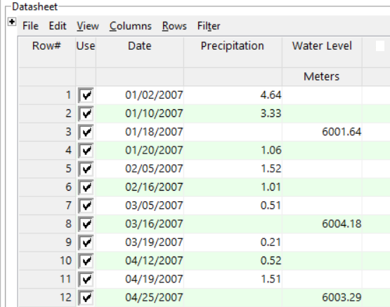
- Measurement Date: Required. Lists the date (and optionally the time) at which the precipitation and/or water level measurement was taken. Must be listed in month/day/year order. Years must be listed with 4 digits.
- Including time notations is optional and would only be applicable when more than one measurement was taken on a single date. During construction of the hydrograph diagram, you may request the axes be labeled at sampling time, or at minute, hour, day, or month intervals. Times may be entered using "am" or "PM" notations (not case-sensitive) or using a 24-hour format. If no "am" or "pm" are present, 24-hour format is assumed. Do not include periods in the "am" or "PM" notations (e.g. "a.m." or "P.M.")
- Precipitation: Required, though not necessarily for each listed date. Precipitation amounts can be entered in any real number units. During creation of the diagram, you may enter unit labels for the axes.
- Water Level: Required, though not necessarily for each date listing. Be sure to define the water level units; see Defining your Datasheet Coordinates and Units for information.
- Hydrology_Hydrograph.rwDat

RockWare home page