RockWorks | Utilities | File | Import | SEG-P1 Option
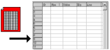
This program is used to import SEG-P1 style shotpoint data into the Utilities data sheet. The program will read the selected SEG-P1 file and determine the points that lie on each seismic line. Each shotpoint will be listed with its line number in column 1. The program will determine the starting and ending points for each line, and list the selected symbols for these points in column 3. It will determine, for each line, the points that lie at the minimum distance you specified, and assign them the indicated symbols. All shotpoints between these labeled points will be assigned the symbols selected for "unlabeled points."
Menu Options
Step-by-Step Summary
SEG-P1 Input File: Click on this large button to browse for the SEG-P1 format data file to be imported.
Symbols: Expand this item to select the graphic symbols to be used to represent the different shotpoint locations. You may select a different symbol for the starting point and ending point of the line. In addition, you may specify which intermediate points will be labeled and which will not be, based on the minimum distance declared below. You may select a different symbol for labeled versus not-labeled points. To select a symbol and color for any of the shotpoint types, simply click on the picture of the symbol and make a selection in the displayed window.
See also
![]() Back to Importing Data
Back to Importing Data
![]()