These files are used to define (or redefine) the contacts within existing stratigraphic logs in the Borehole Manager based on the contents of a list of one or more stratigraphic surface models, using the RockWorks | ModOps | Grid | Grids -> Strat program.
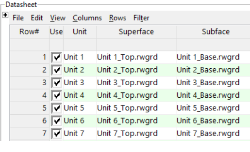
- Unit: Required. In this column you must list the name of the stratigraphic formation that is represented in the grid models in columns 2 and 3.
- ! Each unit that you list here MUST also be defined in the current Stratigraphy Type Table in the Borehole Manager.
- Superface: Required. List the name of the grid model (.RwGrd file) that represents the elevations at the top of the listed unit.
- The grid surfaces and bases must reside in the same folder as the Grid to Logs RwDat file.
- The grid surfaces and bases must all have the same node densities.
- Subface: Required. Enter the name of the grid model that represents the elevations at the base of the listed unit.

RockWare home page