It is used to define which of your formations are to be included in the modeling and display.
- All Stratigraphic Units: Choose this if all units are to be modeled (if the Interpolate Surfaces option is checked) and displayed in the diagram.
- Only Units Flagged As "Show In Legend": You can limit the interpolation (if the Interpolate Surfaces option is checked) and display to only those formations with a check in the Show in Legend check-box, in the Stratigraphy Types table.
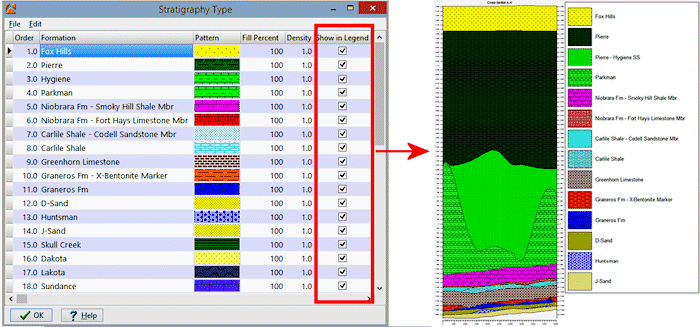
In this example, there are many formations listed in the Stratigraphy Types table, and all have Show In Legend check-marks. In the resulting cross section, all units are displayed.
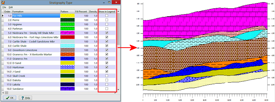
In this example, only the middle units are checked in the Stratigraphy Types table. They are the only formations included in the output cross section, enabling a zoomed-in view of the formations of interest.