Examples of applications:
> Integrating surface geochemistry with downhole geochemistry.
> Integrating surface geophysics with downhole geophysics.
> Integrating surface lithology with downhole lithology.
> Adding "phantom" control points to any type of modeling involving downhole data.
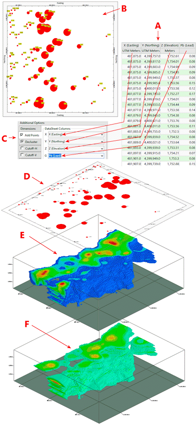
Consider the following scenario. Let's say that we have some surface geochemical (lead) data in a datasheet (A). A proportional circle map (B & D) shows the relative magnitudes of these surface geochemical values. If we load this file into the Utilities datasheet, activate the new Add Points option, enter the appropriate column data (C), and model the corresponding downhole geochemical data via the Borehole Manager | I-Data | Model program, we'll get a model that is based on both the surface geochemistry as well as the downhole geochemistry (E) as opposed to a model based solely on the downhole geochemistry (F).