Step-by-Step Summary
Follow these steps to adjust how 3D surface is to be colored.
- In the data pane of the RockPlot3D window, right-click on the name of the surface to be modified and choose Options.
- Color Scheme: Locate this section of the Grid Options window. By clicking the down-arrow you can see the options.
- Solid: The surface will be colored with a single color; click on the color box to choose the color. (See Draw Style settings to adjust whether the surface is displayed as a solid sheet, a wire frame, etc.)
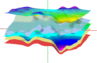
- Gradational: Color-codes the surface based on Z (elevation or other) value. Use the Min-Max button to the right to choose the gradational color palette to use.
- See the Value Range section of the window to set the Z value range to be color-coded. Click the Reset Range button to use the entire Z value range. Or, type in your own values to illustrate a subset of the Z values contained in the grid model.
- Interval: Use this setting to define the color-contouring interval, in your Z units.
- You can click the Info button at the very bottom of the window to see the grid model’s Z-value range.
- Color Fill Table: Choose this if you want the surface to be color-coded based on Z (elevation) values, with the Z-value / Color association listed in a RockWorks Color Fill Table.
- Direct: Choose this option if your surface has been extracted from a color model, in which the interpolated node values represent actual Windows color integers (such as are created by the Colors | Plan program). Using this option, RockWorks will display the surface using the stored colors.
- Lithology Table: If the grid model represents lithology types extracted from a solid model (such as are created by the Lithology | Plan program), choose this option to apply the background colors from the Lithology Types table in the RockWorks Borehole Manager database.
- Stratigraphy Table: If the grid model represents stratigraphy types (such as are created by the Stratigraphy | Plan program), choose this option to apply the background colors from the Stratigraphy Types table in the RockWorks Borehole Manager database.
- Color File: Choose this if you want the surface to be color-coded based on Z (elevation) values, and if you have a text version of your Color Fill Table. Click the button to browse for the color file to be used.
- Lithology File: If the grid model displayed as the 3D surface represents lithology, and if you have a text version of your Lithology Types table, use this option to color the 3D surface with the lithology background colors. Click the button to browse for the lithology file to be used.
- Stratigraphy File: If the grid model displayed as the 3D surface represents stratigraphy, and if you have a text version of your Stratigraphy Types table, use this option to color the 3D surface with the stratigraphy background colors. Click the button to browse for the stratigraphy file to be used.
- Click the Apply button at any time to view the effect of your color changes on the surface. You may need to drag the Options window out of the way to view the display. You do not need to close the Grid Options window to apply and see the changes.
! Using the Apply button tells the program to invoke the changes you have made. You cannot discard changes once they have been applied.
These color schemes can be used with any of the surface Draw Styles.
 Back to RockPlot3D Surface Settings

RockWare home page