Dip Gridding is the newest addition to the RockWorks suite of gridding tools. This algorithm biases the surface modeling based on the dip-direction and dip-angle of the control points. The algorithm also accomodates points for which the dip is unknown.
This gridding method is applicable to geologic structure modeling (elevations) only.
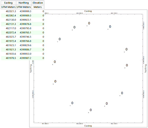
Here's how it works: Consider the control points listed and mapped within the following diagram. Each of the points has a z-value (elevation) of zero. A contour map would be non-sensical because a gridded surface would be a horizontal plane.
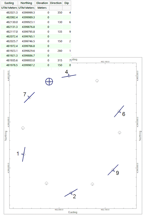
Now, let's say that we have dip information (e.g. strike & dip or dip-direction & dip-angle) for some of these points as shown within the diagram below:
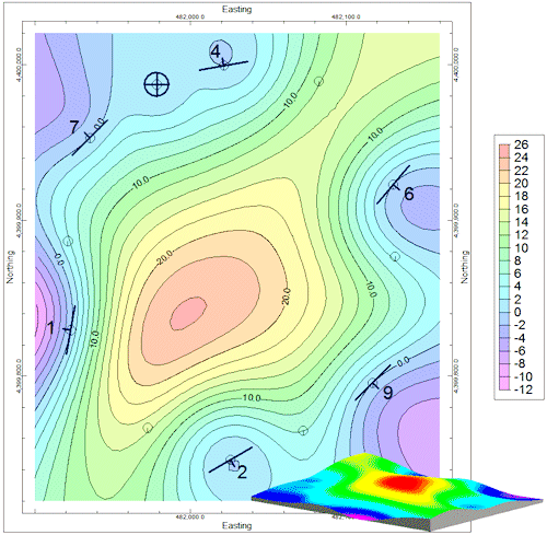
The new dip-gridding algorithm will use the dip information (for the points that have it) to construct imaginary planes that are used to bias the modeling as shown by the example shown below. Specifically, the algorithm computes the plane represented by each strike and dip measurement point. Then for each grid node it determines the elevation at the intersection of that node's XY point and the planes of either all of the structural sample points or a specific number of neighboring points. It computes a distance-weighted average of those elevations. You can also apply a distance filter so that distant structural points won't influence a node.
Notice how the points without dip information constrain the modeling.
Menu Options
Notes
This new gridding method has resulted in the following additions to the program:
![]() Back to Grid Method Summary
Back to Grid Method Summary
![]()