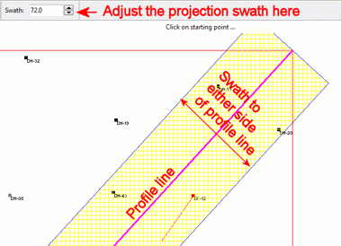
For multi-log profiles, you will see a shaded area to either side of the profile line that indicates the "clipping distance" or "swath" beyond which logs, or portions of logs, will not be displayed in the profile. This current swath distance setting is displayed at the top of the window.
Use the up- or down-arrows next to the swath distance notation to adjust the area to be included in the projected section. For example, if you enter "200", then all boreholes and portions of boreholes 200 feet on either side of the section line will be included in the output diagram.
The swath distance setting can be changed at any time. When a new value is entered, the appearance in the Profile Selection Map will be updated.
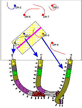
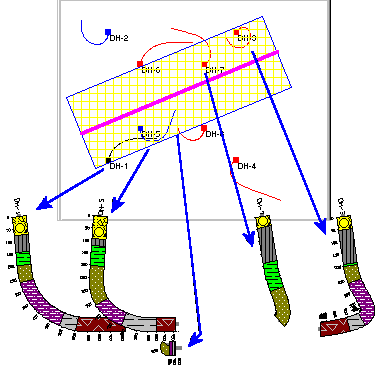
Compare the following examples, which show cross section traces with varying swath distance settings. In the first example, the swath includes three complete wells. In the second example, the swath includes both complete and partial wells.
The clipping distance applies to multi-log profiles, created in the Striplogs | 2D Striplog Profile tool, and to all other Borehole Manager Profile tools (Lithology, Stratigraphy, I-Data, T-Data, P-Data, Fractures, Aquifers, and Colors) to which logs have been appended.
![]()