
RockWorks | Utilities | Coords |
Compute Origin Lon/Lat for Local Coordinate System
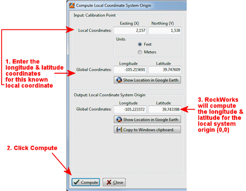
This program is used to compute the "origin" longitude and latitude for a local coordinate system, given a known calibration point. This information can be used to geo-reference a project which uses local coordinates, for output to Google Earth or other GIS program.
Example: Let's say your local gas-station project coordinates are defined simply by local feet from a property corner, but you want to display your output maps and graphics in Google Earth. Solution: You can use this program to enter a known longitude and latitude coordinate for a specific local point, compute the longitude and latitude coordinate for the local system origin (0,0), and enter that origin lon/lat into your RockWorks database or datasheet.
Menu Options
![]() Back to Coords Menu Summary
Back to Coords Menu Summary
![]()