![]()
Use the tools in the RockWorks Utilities program to read a variety of data from the Datasheet Editor, and generate maps, grid or block models, miscellaneous structural or chemistry diagrams, compute statistics, output maps to Google Earth, and much more. These tools are summarized below. Click on the links or images to jump to the topic.
Intro - Maps - Grid Model Tools - Solid Model Tools - Volumetrics - Hydrology Tools - Hydrochemistry Tools - Linear Tools - Planar Tools - Faulting Tools - Statistical Tools - Survey Tools - Coordinate Tools - Widgets - Imagery Tools - Miscellaneous Graphic Tools - RockWorks EarthApps
Entering Data
Intro: Use this menu to access videos, tutorials, sample data.
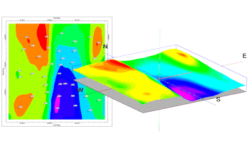
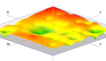
Maps: Read spatial data from the Datasheet Editor, and generate a variety of different maps - points, contours, polygons, 3D points, and more.
Grid Model Tools: Manipulate RockWorks Grid modelss (.RwGrd files) - Statistics, filters, editing, imports, directional analysis.
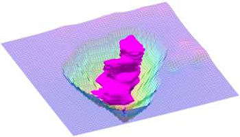
Solid Model Tools: Manipulate RockWorks Solid models (.RwMod files) - Statistics, mathematical operations, filters, editing, imports.
Volumetrics Tools: Compute volumes, create extraction surfaces, create GT reports.
Hydrology Tools: Compute water level drawdown, plot pathlines, create hydrograph diagrams.
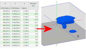
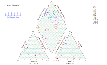
Hydrochemistry Tools: Read ion concentration data from the datasheet, generate a variety of different diagrams, and perform a variety of computations
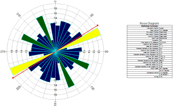
Linear Tools: Read line endpoint or bearing data from the datasheet, generate a variety of different diagrams, and perform computations.
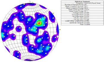
Planar Tools: Read strike and dip data from the datasheet, generate a stereonets, strike and dip maps, structure maps, and perform a variety of computations
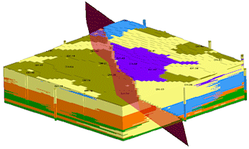
Fault Tools: Read polyline locations, dip direction, and dip angle data from the Datasheet Editor, and generate 3D "dip ribbon" displays, and 3D "fault files" for use in faulting 3D block models.
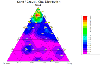
Statistical Tools: Read measurements from the datasheet and compute basis statistics, create frequency histograms, scatterplots, ternary plots, sieve diagams, and more.
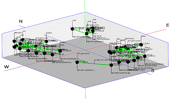
Survey Tools: Generate reports, 2D and 3D maps from survey data.
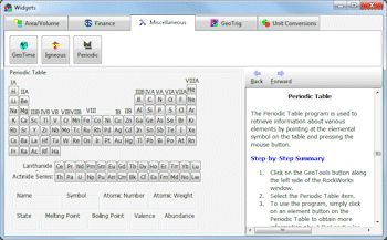
Widgets: Miscellaneous program calculators and reference tools
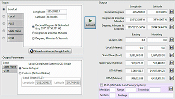
Coordinate Tools: Convert coordinates from a variety of systems.
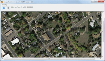
Imagery Tools: Import images into your project, with a variety of manipulation and display options.
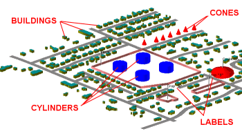
Miscellaneous Graphics Tools: A variety of tools for creating or manipulating 2D and 3D graphics.
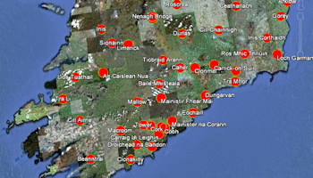
RockWorks EarthApps Tools: Read spatial data from the Datasheet and create a variety output for Google Earth.
![]() Back to RockWorks Introduction
Back to RockWorks Introduction
![]()