RockWorks | Utilities | EarthApps | Extract | Lineations
This program:
- Reads a listing of endpoint coordinates for multiple lines that have been copied or saved in Google Earth.
- Extracts the coordinates from the Google Earth KML structure, converting the coordinates if requested.
- Lists their endpoints in the datasheet.
Menu Options
Step-by-Step Instructions
Menu Options
- Input: Use these settings to define the input for the line data.
- Windows Clipboard: Choose this option if you have copied the lines in Google Earth.
- KML or KMZ File: Choose this option if you have saved the lines in Google Earth, in a KML or KMZ file.
- Input File: Click to the right to browse for the KML or KMZ file containing the lines to be brought into RockWorks.
- Output: Use these settings to determine the coordinate system and units in which you want the lines to be recorded within RockWorks.
- Decimal Degrees: Select this option to list the coordinates in decimal longitude (X) and latitude (Y) degrees.
- Local Coordinate System: Select this option to list the coordinates in local feet or meters. Expand this heading to define:
- Origin Longitude: Click to the right to enter the decimal longitude coordinate at your local coordinate origin (0,0).
- Origin Latitude: Click to the right to enter the decimal latitude coordinate at your local coordinate origin (0,0).
- Units: Choose whether the local coordinates are to represent feet or meters.
- US State Plane: Select this option to list the coordinates in a State Plane coordinate system. Expand this heading to define:
- Zone: Click to the right to choose the State Plane Zone within which the coordinates are to be based.
- Units: Choose whether the State Plane coordinates are to represent feet or meters.
- Universal Transverse Mercator: Select this option to list the coordinates in a UTM coordinate system. Expand this heading to define:
- Datum: Click to the right to choose the UTM Datum
- Zone: Click to the right to choose the UTM Zone within which the coordinates are to be based.
- Units: Choose whether the UTM coordinates are to represent feet or meters.
Step-by-Step Summary
- In Google Earth, create the lines that you wish to bring into RockWorks. Or, locate the line group that currently exists in your Saved Places listing.
- Right-click on the group, and choose Copy from the pop-up menu.
Or, right-click on the group, and choose Save Place As to save the locations in a KMZ file.
- Start up RockWorks if necessary.
- Access the Utilities program tab.
- Create a new datasheet if necessary.
- Select the RockWorks | Utilities | EarthApps | Extract | Lineations menu option.
- Enter the menu options as described above.
- Click the Process button to continue.
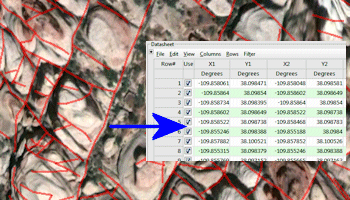
The program will scan the data in the clipboard or specified KML/KMZ file. It will perform any coordinate conversions which are requested, and record the endpoint coordinates for each line in the Datasheet.
See also: Utilities Linears Menu
 Back to Extract Map Summary
"Google" is a trademark of Google Inc.

RockWare home page